Yarra Ranges Integrated Transport Strategy
We prepared a 20-year Integrated Transport Strategy for Yarra Ranges, a peri-urban and partly rural municipality on the eastern fringe of Melbourne.
Location
Yarra Ranges, Melbourne
Budget
$256,000
Commencement
2019
Completion
2020
Overview
We prepared a 20-year Integrated Transport Strategy for Yarra Ranges, a peri-urban and partly rural municipality on the eastern fringe of Melbourne. The Strategy was endorsed by Councillors in May, 2020. Community consultation was an important element in the development of the Strategy, and this included pop-up sessions, online surveys and interactive online maps of both the strengths and limitations of the transport system.
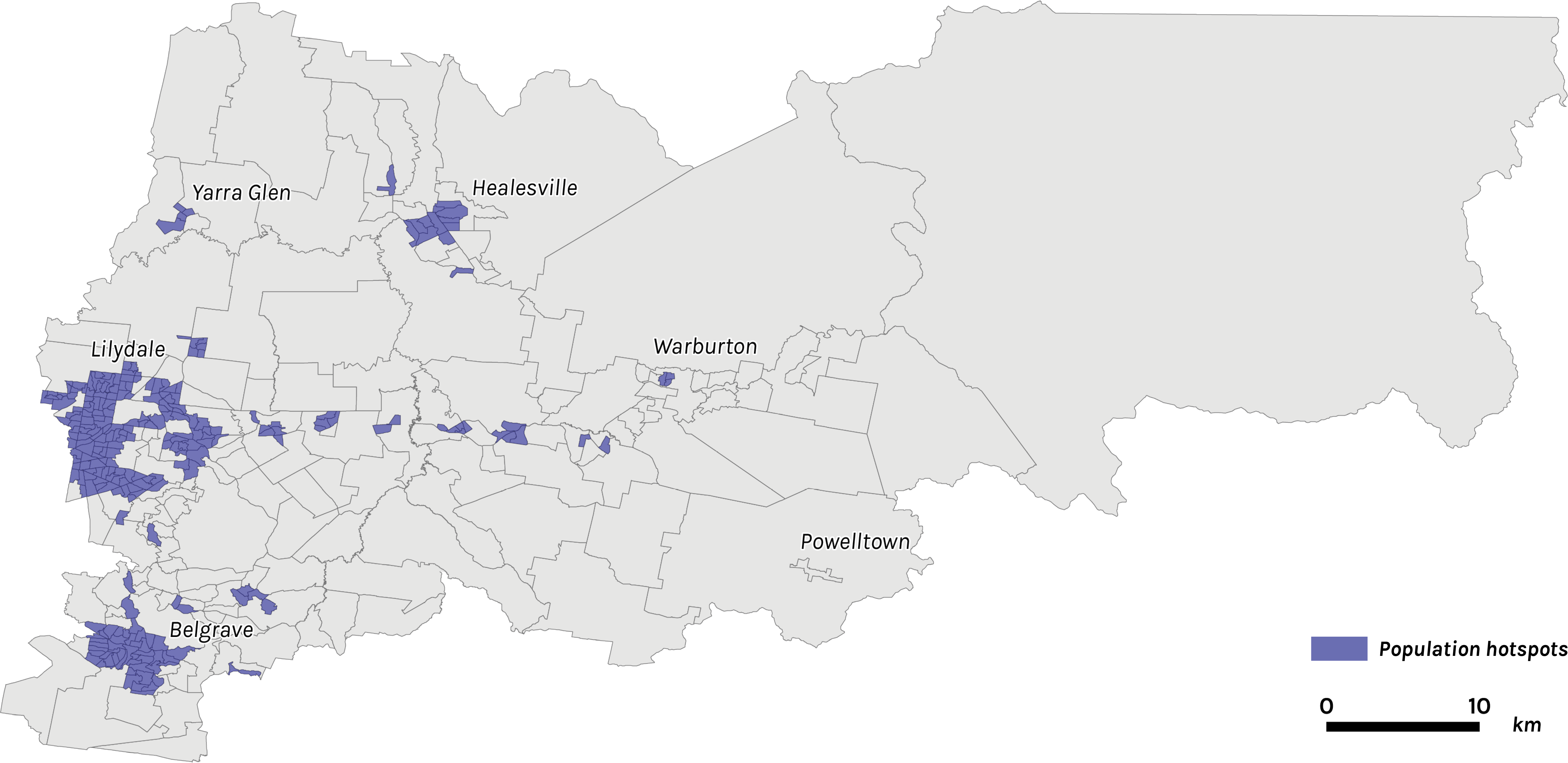
A detailed analysis of existing travel behaviour was undertaken, and this found that over half of all car trips were under three kilometres, partly dispelling the myth that most car trips are too long to do by foot or bike. Our analysis of land use patterns also found that 90% of the population lives in just 9% of the land area.
What we did
Our team prepared all aspects of Yarra Ranges Integrated Transport Strategy. This 20-year blueprint for guiding investment and policy direction involved our team leading:
- Demographic and data analysis related to transport choice in Yarra Ranges
- Detailed mobility analytics to gain a strong understanding of travel patterns in different parts of the Yarra Ranges
- Comprehensive stakeholder engagement, including pop up sessions, online surveys and community workshops
- Working closely and collaboratively with Councillors and senior Council staff.
Yarra Ranges is big, but the population is concentrated
While Yarra Ranges is among the largest local government areas in Melbourne geographically, our analysis revealed that the population is concentrated within a defined area. Some 90% of the population live in just 9% of the land area. This is important, as it suggests that many trips will be short enough to consider shifting to walking or cycling, the infrastructure is there to support these decisions.

Many car trips in Yarra Ranges are short
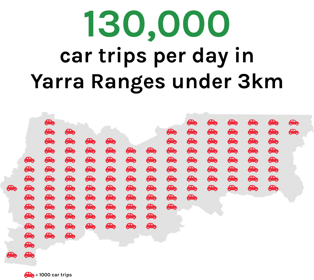
Using a combination of Census and VISTA household travel survey data, our team was able to identify that approximately 130,000 car trips are taken each day in Yarra Ranges under 3km.

Bring transport data to life
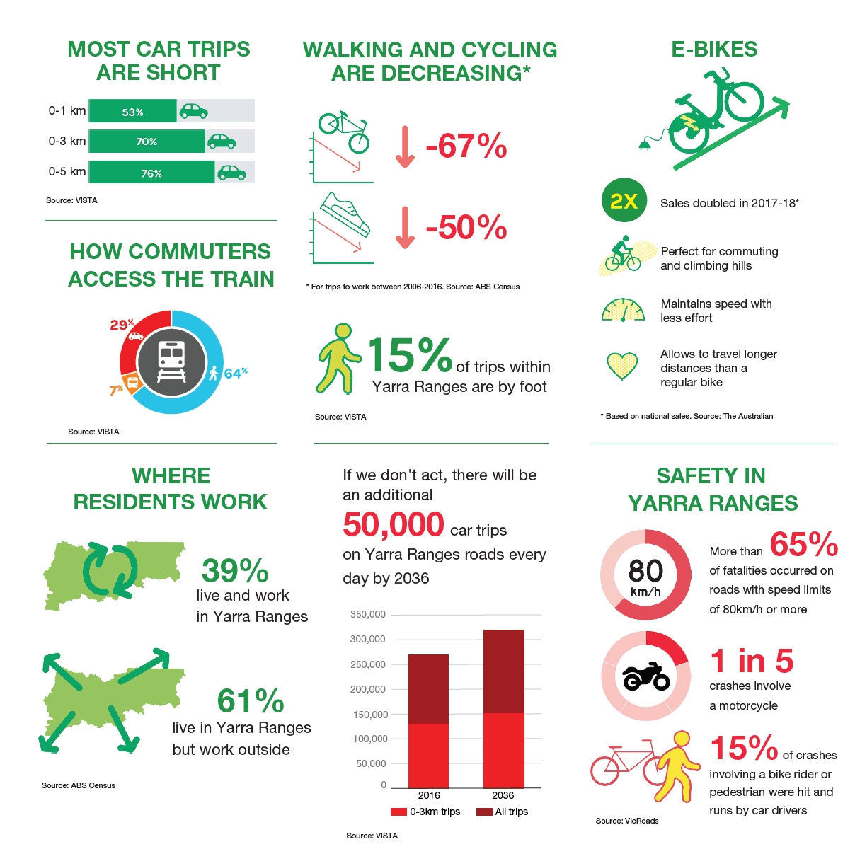
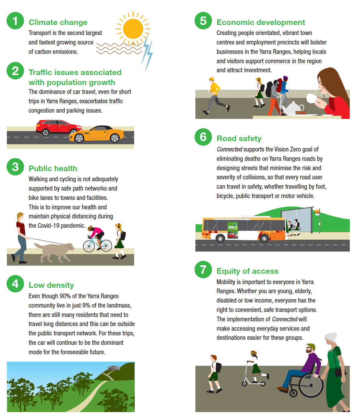
Community engagement was a key component in the development of the Strategy. We developed a transport data infographic (see below), to help guide community discussion around better transport options for the future.

Explaining the Strategy with a video
The Yarra Integrated Transport Strategy included some bold actions designed to achieve sustainable changes in how we travel. We helped produce a short video to explain to the community why change is necessary and what to expect once the Strategy begins its implementation phase.

Big issues facing Yarra ranges
Yarra Ranges is a collection of unique towns and villages, closely connected to some of the most beautiful natural environments in Australia. The lifestyle that makes living in the Yarra Ranges so special is coming under threat from a range of issues that can be partially addressed through effective transport policy. The big issues facing Yarra Ranges which the Strategy will help address are captured in the image on the left.
In our work developing long-term integrated and sustainable transport strategies, we ensure our actions target the big issues facing society.


