Frankston Integrated Transport Strategy
We were commissioned to prepare the new Frankston Integrated Transport Strategy, titled Connecting Communities. It provides a strategic blueprint for guiding transport investment and policy decisions over the next two decades to 2042.
Location
Melbourne
Budget
$120,000
Commencement
2021
Completion
2023
Overview
Frankston City Council commissioned us to develop a 20-year, forward-thinking Integrated Transport Strategy to enhance sustainable mobility options in Frankston. The Strategy involved designed transport data analysis, community consultation, site assessment as well as land use and demographic analysis. All modes of land transport were considered, with a focus on opportunities to enhance pedestrian and cycling outcomes, integrated public transport and more effective management of car parking and traffic.
What does the Frankston Integrated Transport Strategy involve?
Connecting Communities is the new Integrated Transport Strategy for the City of Frankston. It is the key strategic document that acts as our blueprint for guiding transport planning and decision-making over the next two decades. The pressing challenges are outlined, and the big moves required to make getting around Frankston convenient, safe, and more sustainable are identified. Connecting Communities highlights our current travel patterns, and a set of targets and actions designed to respond to the community’s concerns and aspirations regarding transport and accessibility.
Connecting Communities creates the framework and direction to align transport investment and policy decisions with the aspirations the community hold for Frankston’s future. A well-implemented Integrated Transport Strategy ensures we are all moving in the same direction, to get the outcomes we want, to create a Frankston that is:
- Safer
- Healthier
- More connected
- Sustainable, and
- More inclusive.
Frankston currently has a population of 142,147 and is projected to grow to 163,610 by 2041. As one of the most car-dependent communities in Greater Melbourne, it is difficult to overstate the magnitude of the challenge Frankston faces. Around 92,000 car trips take place every day in Frankston that are under 3km. The consultation element of this project heard the community want more options to get around without having to always get in their car.

Community engagement
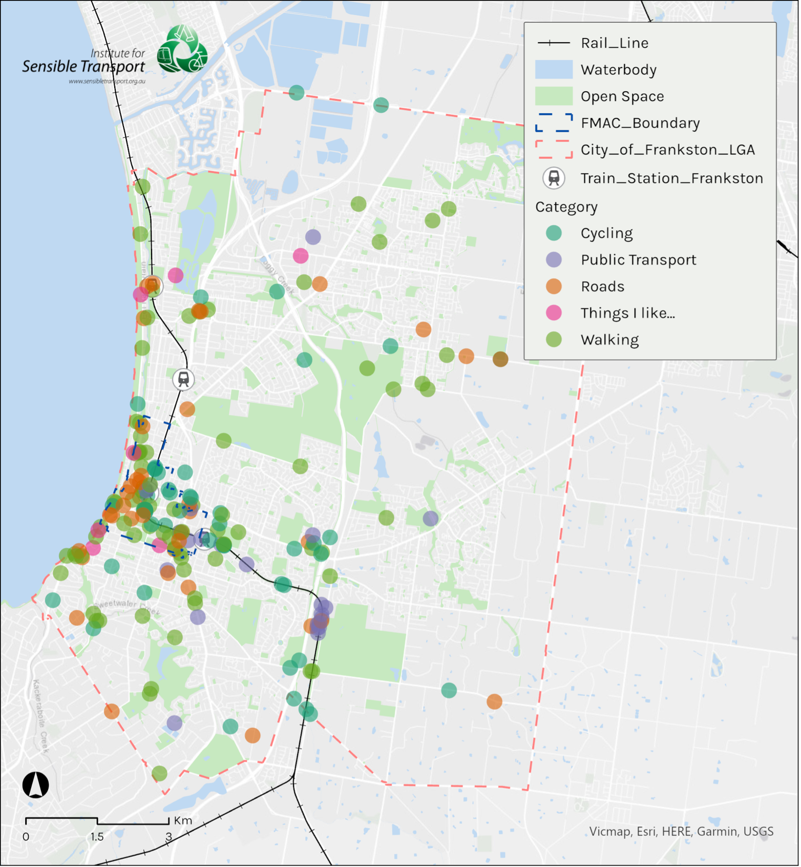
A series of community engagement activities were conducted at different stages in the development of the Integrated Transport Strategy. The map below provides a snapshot of the different issues identified by the community. Each dot contained information that enabled our team to investigate the issue and seek to address it as part of the Strategy.

Creating a vision and guiding principles
Connected Communities takes a strategic approach and is built around a vision. This Vision is:
Transport in Frankston will support a healthy, liveable, safe, sustainable, and inclusive city that enables everyone to participate in our community and economy.
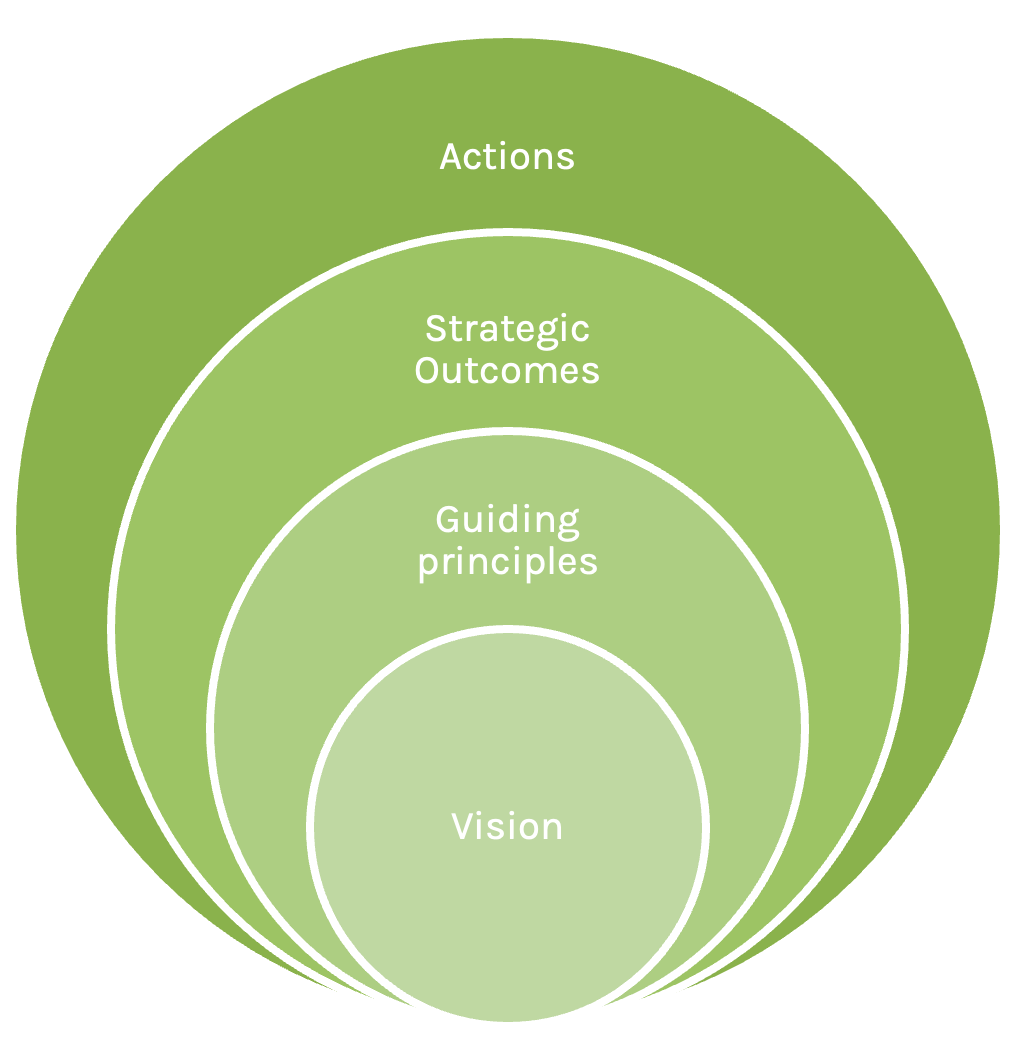
This vision is then supported by a set of guiding principles and can be measured through a range of strategic outcomes. The six strategic outcomes provide more substance to guide Council’s pathway to turning the guiding principles into reality. Specific actions are then developed, that all together, will help realise our vision for Frankston’s transport system by 2042.
Guiding principles
Connecting Communities is guided by the following principles:
- Activity centres are vibrant and people-focused, allowing everyone to participate fully in our community and economy.
- Public transport offers a viable transport option with fast, frequent, and accessible trains and buses.
- Public transport hubs are connected with safe and convenient walking and cycling networks.
- Walking and cycling are the first choice for short trips, supported by safe, connected, and attractive networks.
- Implementation of a Safe Systems approach will ensure our road network is designed to ensure everyone can travel safely across Frankston. Fatalities and lifelong injuries are no longer acceptable on our streets. We are committed to Vision Zero.
- Ensure transport choice is available for everyone, so that for every trip, people can choose ‘the best tool for the job’.
- Demand for car use is reduced to support Council’s vision and objectives.
- We commit to Net Zero emissions in our transport network, including a transition towards zero emission vehicles and increasing sustainable mobility.


Establishing a mode hierarchy
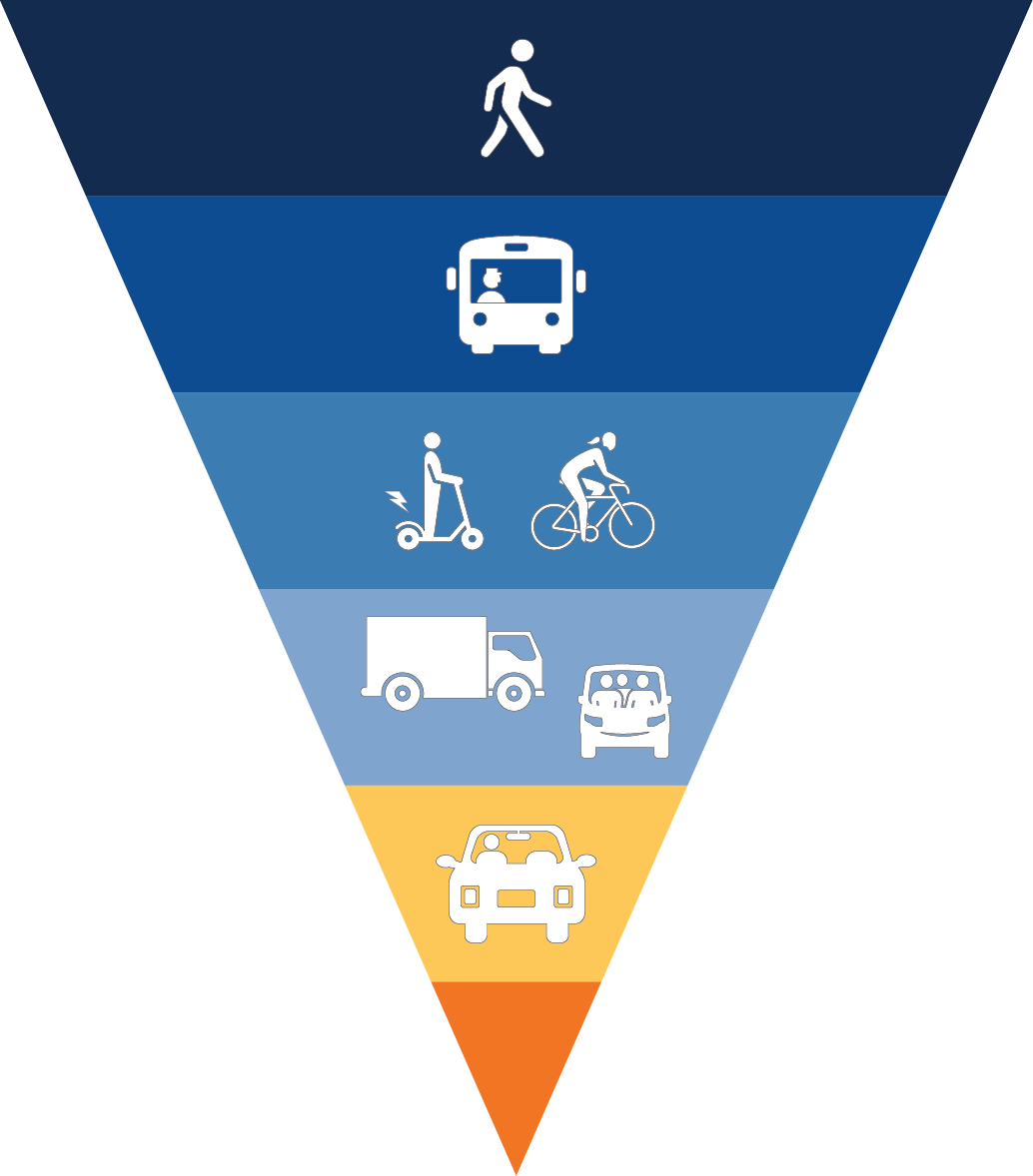
Mode hierarchies help authorities make decisions about changes to the road network. When faced with a tough choice about who should get priority, mode hierarchies can guide decision-making.
To ensure that sustainable mobility plays a greater role in the transport system, in order to reduce congestion and emissions, and enhance road safety and transport affordability, walking, cycling and public transport are at the top of the hierarchy.
Developing mode share targets
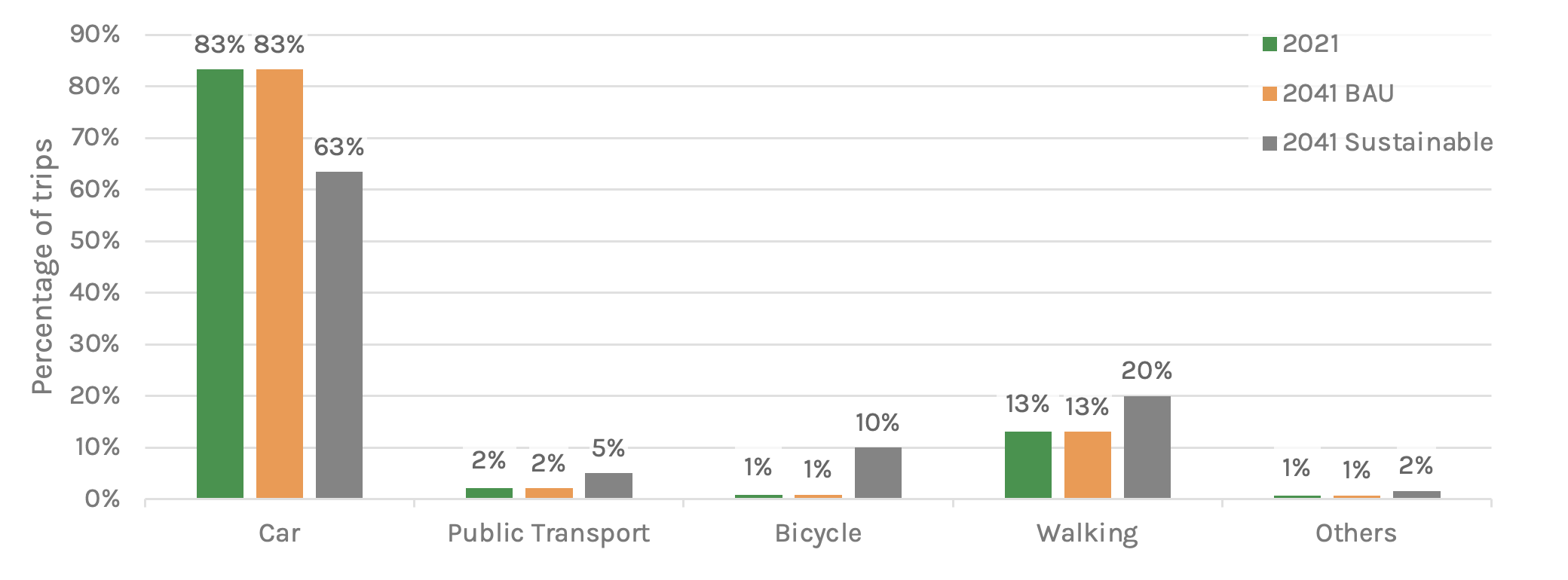
A series of transport scenarios have informed the development of Connecting Communities. We have used these scenarios to create achievable targets that will assist in realising the vision for transport and monitor our progress. These scenarios are based on current transport patterns, from VISTA (2018) data (for all trips) and the latest ABS Census (2016) data (for work trips), scaled up to 2021.
Two future scenarios are offered – a business-as-usual scenario, which is what we would expect to happen if we do not change the way we plan transport and a sustainable scenario, which includes ambitious and achievable targets for making sustainable transport accessible to more of our community. Each of these scenarios have a forecast year of 2041.

Integrating the Movement and Place framework
Movement and Place is a framework that is used in a growing number of state and local governments, both in Australia, New Zealand and a number of other countries.
At the heart of Movement and Place is a recognition of the dual role that streets perform in terms of being a movement corridor and a place in itself. Implicit in the Movement and Place framework is an acknowledgment that in past decades, the role of the motor vehicle and vehicle throughput has been the primary goal underpinning street design, and this can at times be to the detriment of the place function that many streets perform, as well as their ability to support walking and cycling.
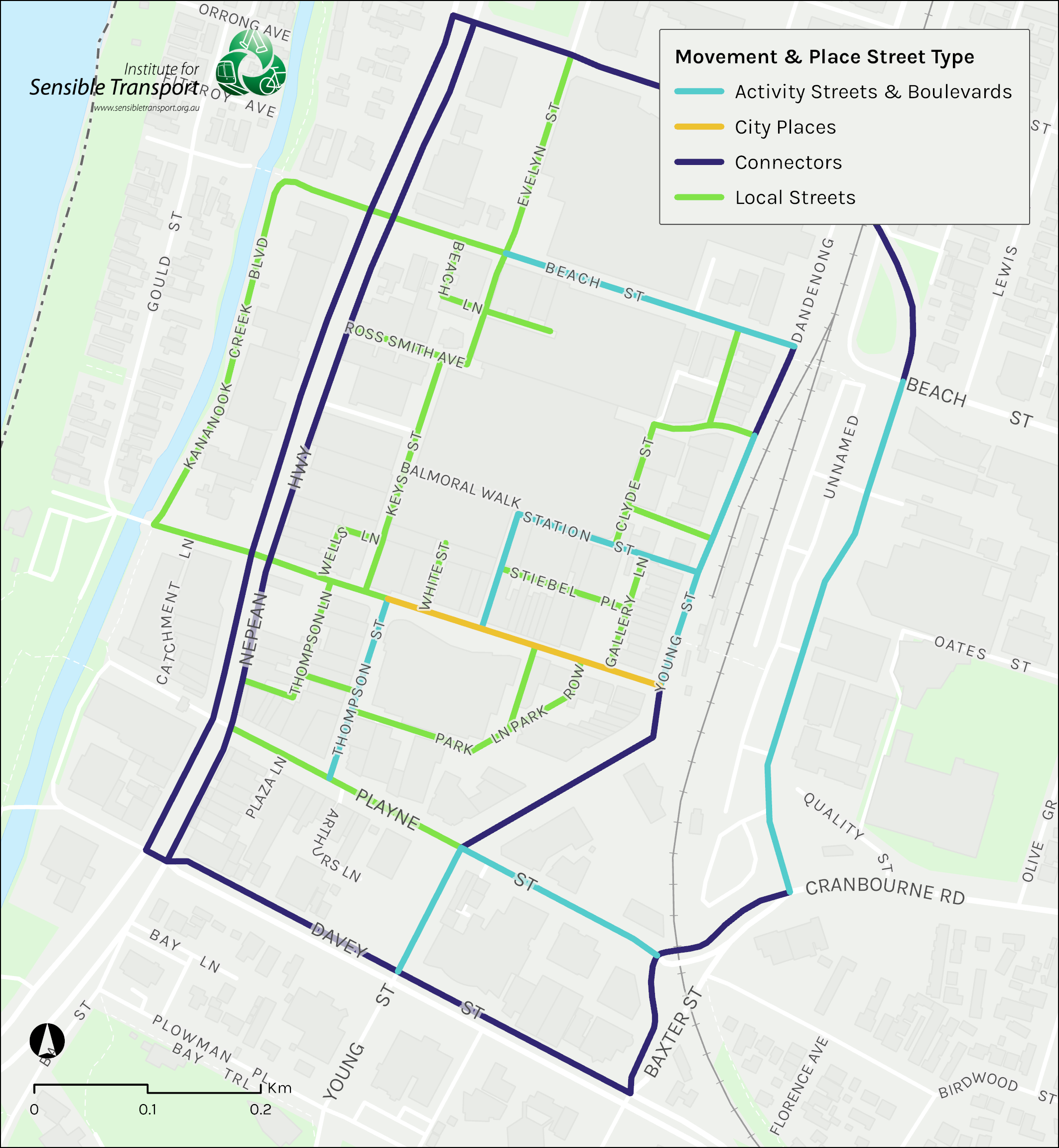
We have used Movement and Place in Frankton to identify the streets that have greater potential to be places in their own right, as well as streets that offer a stronger movement function.

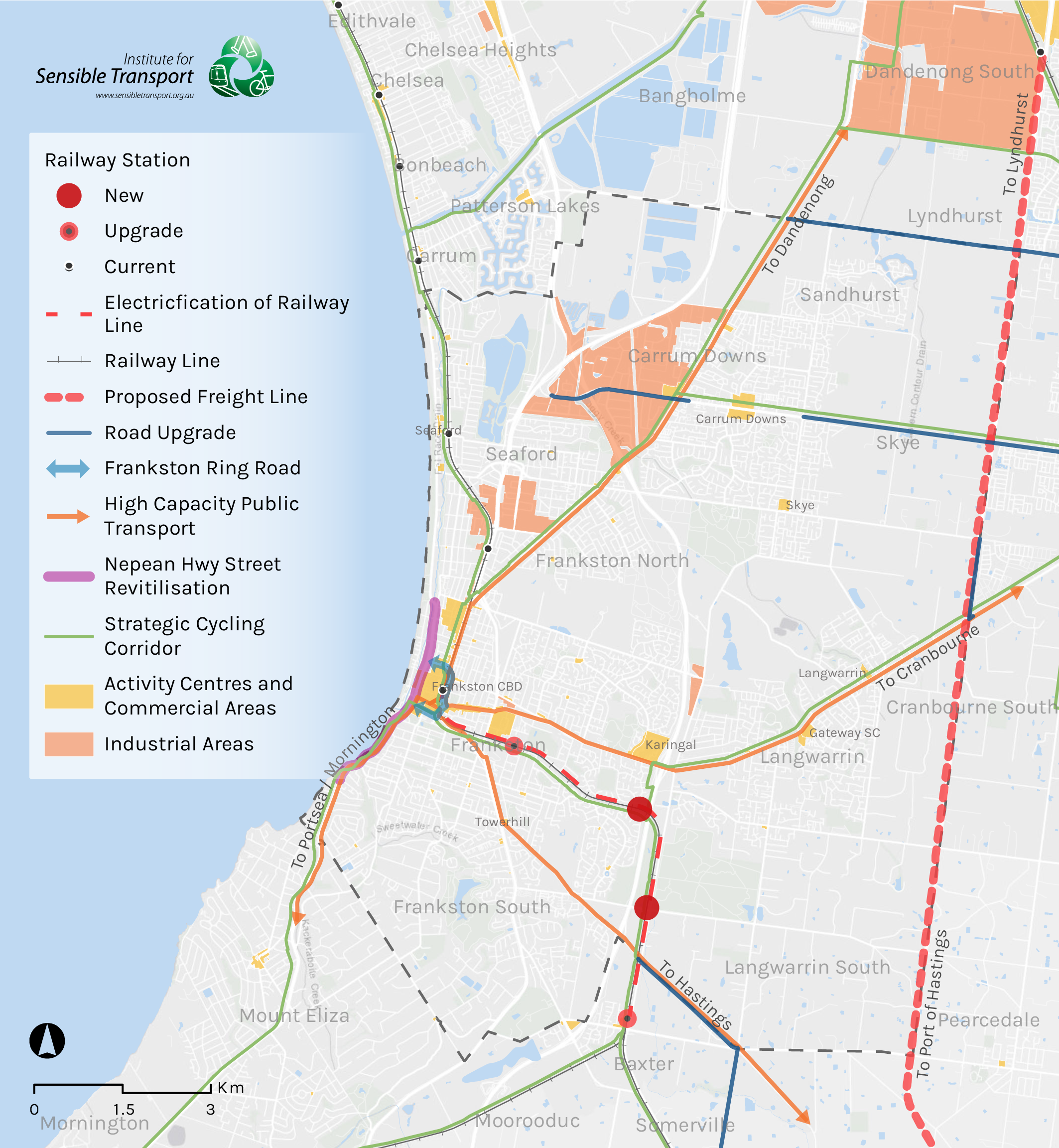
Highlighting the key upgrades to the Frankston Transport System
We’ve identified some of the main upgrades required to achieve Frankston’s vision for 2042. These are documented on the map below and include improvements to walking and cycling, electric vehicle charging and public transport upgrades.


 More info about this project