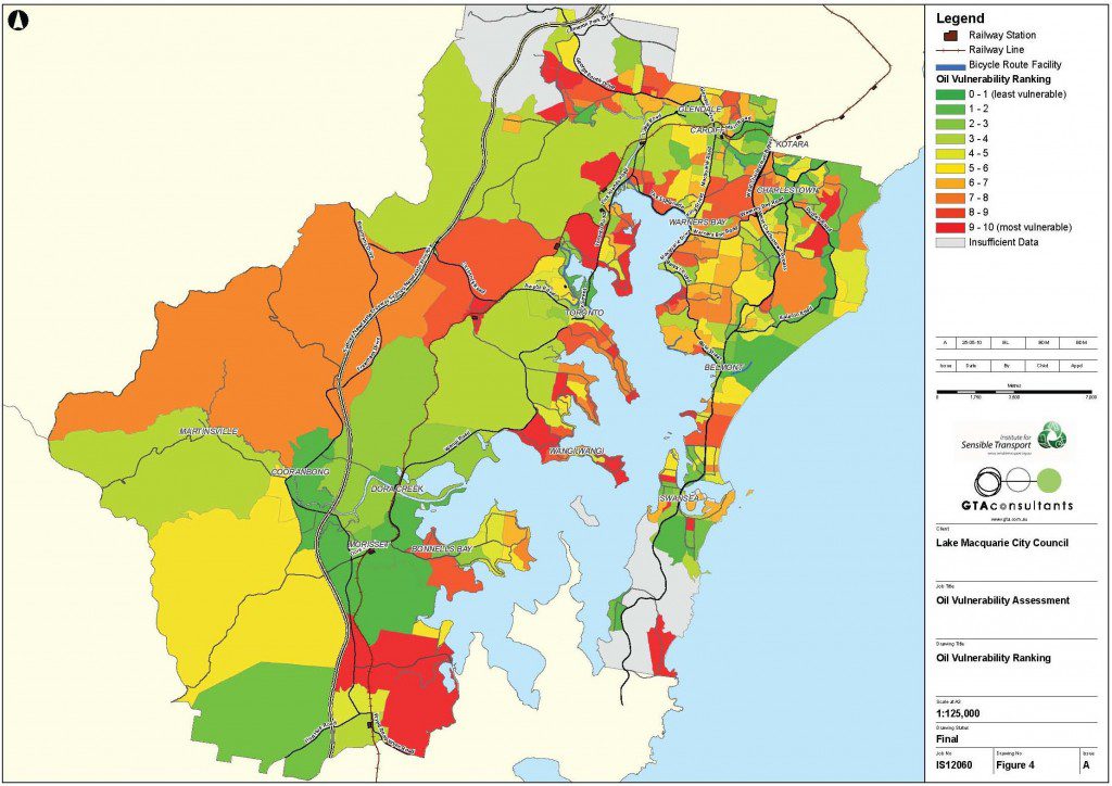
The Institute for Sensible Transport were engaged by Lake Macquarie City Council to investigate differences in oil vulnerability within their municipality. Located on the central coast of NSW, it is the first study of its type in regional Australia and was based on pioneering work by Jago Dodson and Neil Sipe from Griffith University.
The data used to measure oil vulnerability included:
- The proportion of residents indicating they used their car to get to work on Census day 2006
- Car ownership per capita
- SEIFA Index – a measure of economic resources relative to other areas of Australia.
The map below provides an illustration of how oil vulnerability varies across the Lake Macquarie municipality, based on the above three variables.

The report provided several key recommendations designed to reduce future vulnerability to oil price/supply constraints. The full report can be downloaded here.
